Aerial 360s in Crime Scene Photography
Background
Throughout this series, we have taken a high-level view of the tools and techniques used in modern crime scene reconstruction in terms of image capture. Our primary focus is on the various types of photography. Within this realm, investigators use 3 levels of images when photographing any given crime scene.
Overalls
As the name implies, these shots provide a global perspective of the crime scene. Much like a map, the overalls join disparate images of the crime and communicates the relationship among them. They also provide locations for each piece of evidence and where they are positioned in relation to the holistic crime scene. An example might be the outside of a building including the yard, or the inside of a room. Typically, these are taken from intermediate to long-range, and the individual images are pieced together like a puzzle and viewed, analyzed, and presented as a 2-dimensional mosaic.
Mid-range
Mid-range photos bridge the gap between overall and close-up shots and are helpful in defining the appearance of the evidence and space at the time nearest to the time of the crime and are shot at an intermediate to close distance. These may be represented as a body lying on the ground or as a piece of evidence such as a knife or a gun.
Closeups
These capture the fine details of minute pieces of evidence. Such examples can include a bullet wound on a victim, a gash on a door, or a bloodstain on clothing. They are often taken from multiple angles and with a ruler or measuring tape in at least one scene to provide scale. For these types of images, they must maintain the original integrity of the object as the evidence may be re-analyzed for years to come in the situation where a cold case may be reopened decades after the original crime.
Aerial 360 Photographs
In previous articles, we have discussed the advantages of 360° panoramic images in crime scene photography. Mainly that an entire scene can be captured in a single continual image interactively and with varying degrees of resolution depending on the equipment used. A high-resolution Gigapan can be used to encompass both overall and mid-range images since the image can be viewed from a very wide angle with the ability to close in on small details with high resolution.
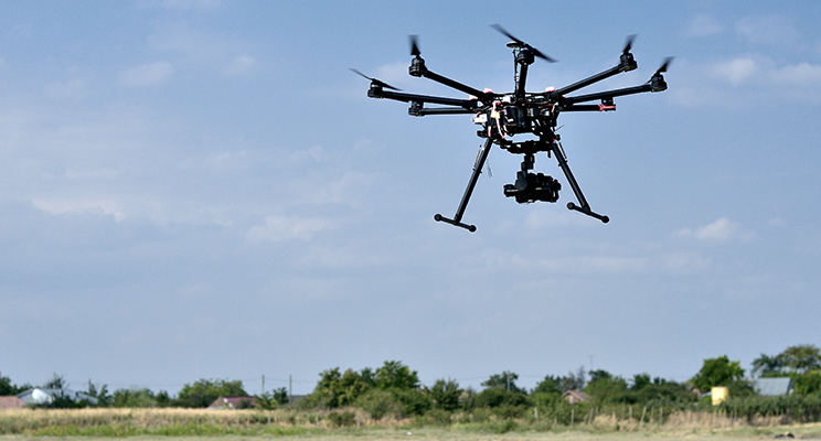
An aerial panorama provides the greatest overall image for an outdoor scene as it encompasses a much larger distance and area that is quickly and efficiently captured using an elevated mast or professional grade UAV.
As illustrated in the virtual 360 crime scene example below, the aerial panorama can provide much greater insight than a series of 2-dimensional photos alone.
Example CSI:360 Virtual 360 Crime Scene: Manitou Springs Training Scene
A scene such as this may lead investigators to view what other individuals witnessed from a crime scene at surrounding residences or any surveillance cameras that may have captured live video of the crime. By analyzing such a scene, entry and exit routes can be determined as well as the level of premeditation and planning involved in the crime.
In the courtroom, such a tool helps prosecutors effectively walk the jurors through the crime scene with greater effect and efficiency.
Tools and Techniques
As we’ve mentioned in previous articles, the best and most reliable method for capturing high-resolution 360° images is using a stationary professional grade SLR camera. There is no better combination of lens and image sensor that produces a better image given the cost than the DSLR. However, this becomes challenging when shooting an elevated panorama since the DSLR platform must be manually controlled.
In these cases, it is most suitable to use a dedicated 360° panoramic camera as it is able to remotely capture a single image in 1 single pass.
Aerial Drone Platform
Many of the consumer and commercial UAVs on the market today have the built-in ability to photograph 360° still images by shooting and stitching a scene in sequential rows and columns much like the Gigapan Epic Pro. However, the key problem is that the drone is an unstable platform moving and shifting with the wind. Unless perfectly calm, these onboard 360s are almost always prone to stitching errors and blur. Please see the following examples below.
Example VPiX Virtual 360 Errors: Common issues with onboard aerial 360 images
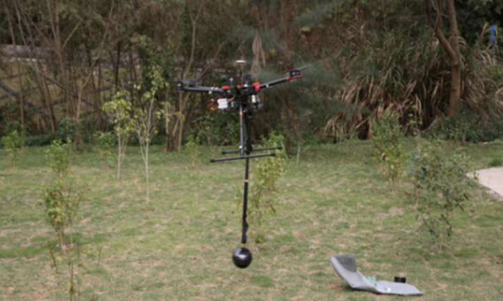
For these reasons, the most convenient and reliable method of capturing aerial panoramas is to mount a dedicated 360° camera to an aerial drone platform.
Instant capture 360 cameras shoot an entire scene in a single exposure, firing multiple lenses at once. This greatly reduces the possibility of image shifting between lenses. With superior onboard stitching and image processing, units like the Insta360 Pro 2 pictured below, capture very high-quality panoramas in stunning HDR (High Dynamic Range).
The Insta360 Pro 2 mounted below the DJI Matrice 600 Pro
Stationary Aerial Mast
With increasing federal and state regulations around public UAV deployment, the ability to use drone photography in the public sector also becomes more challenging, costly and time-consuming in terms of training, and adherence to increasingly stringent regulations.
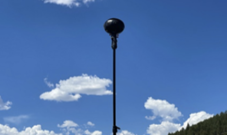
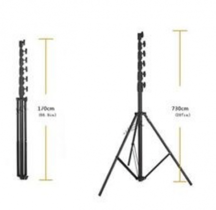
For this reason, CSI:360 provides the option to deploy the Insta360 Pro 2 or Titan 11K to the Manfrotto Professional 24’ stabilized camera platform.
The Manfrotto / Insta360 combination is compact and can be set up quickly to provide high-level panoramas at midrange at a fraction of the cost and red tape involved in certifying a UAV platform and photographer/operator.
This by no means replaces the capabilities of a UAV but can provide a good 70% of required aerial panoramic imagery.
Example VPiX Virtual 360 Tour: Aerial Samples –
Elevated Mast vs UAV
Comparison of Aerial Platforms
UAV
Pros
- Much greater height limit
- Ability to reach areas inaccessible by vehicle or by foot
- Can be used for remote surveillance
- Can be fitted with various sensors’ LiDAR, Infrared….
- Can shoot, photograph, video, 360
Cons
- Can be costly to purchase
- UAVs are prone to failure adding to the cost of maintaining and replacing
- Requires certified pilot adding to above costs
- Limited by weather (wind or rain)
- Regulated by various federal, state, and local statutes
Aerial Mast
Pros
- Inexpensive
- Easy to deploy
- Sturdy and not as limited by weather
- Does not require certification
- Far less regulated
- Can cover about 70% of department needs
Cons
- Limited height
- Limited to what is accessible by vehicle and by foot
- Far more limited in terms of capability and flexibility
Conclusion
There are many considerations in deciding which platform best suits your needs as far as aerial photography is concerned. By far, the UAV platform offers the most versatility and flexibility, but this comes at a cost that must be weighed against your departments’ personnel or budget. The heavier the camera, the higher the price of the UAV, such as an Insta360 Pro 2 or greater. In addition, the ongoing cost of maintenance, replacement, and training (as regulations evolve) will also add to the overall budget.
Regardless of platform, The CSI:360 team and software can accommodate any method of image capture. The open and flexible CSI:360 platform is compatible with any camera system. Our CSI:360 consultants provide top-notch training in all forms of aerial photography.
If you are considering making the move to an aerial system, please speak with a CSI:360 team member to discuss your situation and options.

